Aerial Mapping and Surveying
Build Your Dream
Aerial Mapping and Surveying Services
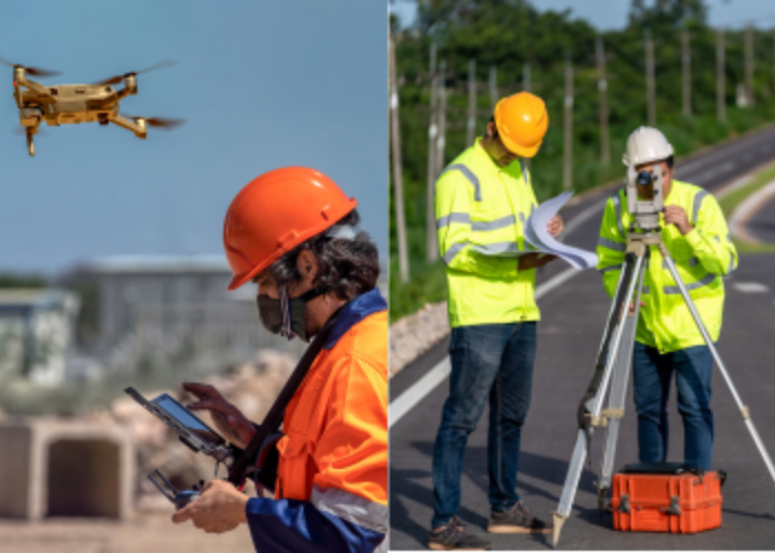
Civitech’s Aerial Mapping and Surveying services revolutionize project insights by leveraging cutting-edge drone technology and unparalleled surveying expertise. Our comprehensive approach to data collection goes beyond conventional methods, offering precise and high-resolution information crucial for informed decision-making and optimized project execution.
With the integration of advanced drone technology, we transcend traditional surveying limitations. Our fleet of drones is equipped with state-of-the-art sensors and cameras capable of capturing intricate details of landscapes, infrastructure, and construction sites with exceptional accuracy. This aerial perspective provides a holistic view, enabling us to gather comprehensive data swiftly and efficiently.
At Civitech, our team comprises skilled professionals who blend technical prowess with industry-specific knowledge. They meticulously plan and execute each aerial mapping and surveying mission, ensuring the collection of precise data points essential for project planning, design, and implementation. Through our expertise, we deliver actionable insights that facilitate strategic decision-making at every project phase.
The benefits of our services extend across various industries, including urban planning, real estate development, infrastructure construction, environmental conservation, and more. By harnessing the power of aerial mapping and surveying, we empower our clients to make informed decisions backed by accurate and reliable data.
The utilization of drone technology not only enhances the accuracy of data collection but also significantly reduces time and costs associated with traditional surveying methods. Our streamlined approach enables faster data processing and analysis, expediting project timelines and ensuring efficient resource allocation.
Furthermore, our commitment to quality extends beyond data collection. We prioritize delivering actionable insights by employing sophisticated data analytics tools and methodologies. This results in comprehensive reports and visual representations that facilitate clear and concise interpretation of complex spatial data.
Ultimately, Civitech’s Aerial Mapping and Surveying services redefine the standards of precision, efficiency, and reliability in data collection for projects of all scales. Our dedication to harnessing innovative technology and expert knowledge empowers decision-makers to drive projects forward with confidence, ensuring optimal outcomes and successful project completion. Trust Civitech to elevate your project insights through our advanced drone technology and surveying expertise.
Trust and Worth
Our Clients
